LEGISLATIVE HISTORY
Planning & Zoning Committee

ENACTED 11/17/1998
ORDINANCE NO. O98-1419
An ordinance to amend Title 17 of the Metropolitan Code of Laws, the Zoning Ordinance of The Metropolitan Government of Nashville and Davidson County, by changing from CL District to CS District properties located at 1063 and 1067 East Trinity Lane, approximately 600 feet west of Gallatin Pike (.63 acres) (Proposal No. 98Z-170U), all of which is more particularly described herein.
NOW, THEREFORE, BE IT ENACTED BY THE COUNCIL OF THE METROPOLITAN GOVERNMENT OF NASHVILLE AND DAVIDSON COUNTY:
SECTION 1. That Title 17 of the Code of Laws of The Metropolitan Government of Nashville and Davidson County, be and is hereby amended by making certain changes in the Official Zoning Map for Metropolitan Nashville and Davidson County, which is made a part of said Title 17 by reference, as follows:
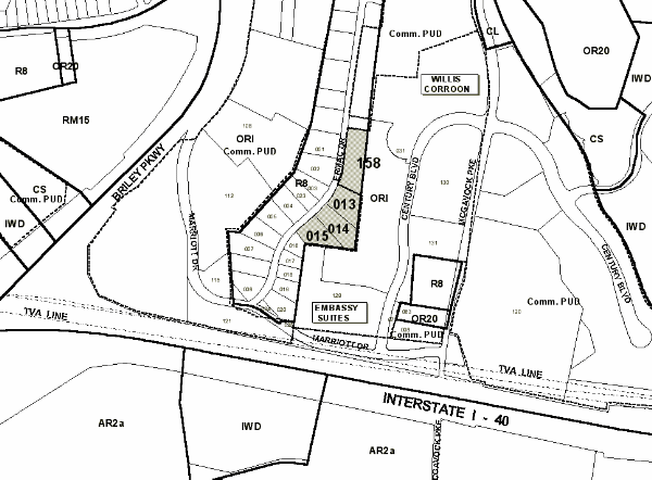
By changing from CL District to CS District properties located at 1063 and 1067 East Trinity Lane, approximately 600 feet west of Gallatin Pike (.63 acres), being more particularly described as being Property Parcel Nos. 213 (.47 acres) and 214 (.16 acres) as designated on Map 76-6 of the Official Property Identification Maps of The Metropolitan Government of Nashville and Davidson County, all of which is more particularly described by lines, words and figures on the attached plan, which is attached to and made a part of this ordinance as though copied herein.
SECTION 2. BE IT FURTHER ENACTED, That the Metropolitan Clerk is hereby authorized and directed, upon the enactment and approval of this ordinance, to cause the change to be made on Sheet No. 76 of said Official Zoning Map for Metropolitan Nashville and Davidson County, as set out in Section 1 of this ordinance, and to make notation thereon of reference to the date of passage and approval of this amendatory ordinance.
SECTION 3. BE IT FURTHER ENACTED, That this ordinance take effect immediately after its passage and such change be published in a newspaper of general circulation, the welfare of The Metropolitan Government of Nashville and Davidson County requiring it.
Map & Parcel No./Owner/Requested by:
76-6-213 & 214 Kenneth D. Flatt
Sponsored By: Earl Campbell
AMENDMENT NO. 1
TO
ORDINANCE NO. O98-1419
Mr. President:
I move to amend Ordinance no. O98-1419 be deleting the phrases "Map
76-6" as it appears in Section One and attached sketch thereof and substituting the
phrase "Map 72-6", and by deleting the phrase "Sheet No. 76" as
it appears in Section Three and substituting the phrase "Sheet No. 72."
Sponsored By: Earl Campbell
Amendment Adopted: November 5, 1998
LEGISLATIVE HISTORY |
|
|---|---|
| Introduced: | October 6, 1998 |
| Passed First Reading: | October 6, 1998 |
| Referred to: | Planning Commission Planning & Zoning Committee |
| Amended: | November 5, 1998 |
| Passed Second Reading: | November 5, 1998 |
| Passed Third Reading: | November 17, 1998 |
| Approved: | November 20, 1998 |
| By: | |